Skyguide, AirMap and FOCA launch nationwide drone management system

exc-5d4c404f4f33ef0001225cd3
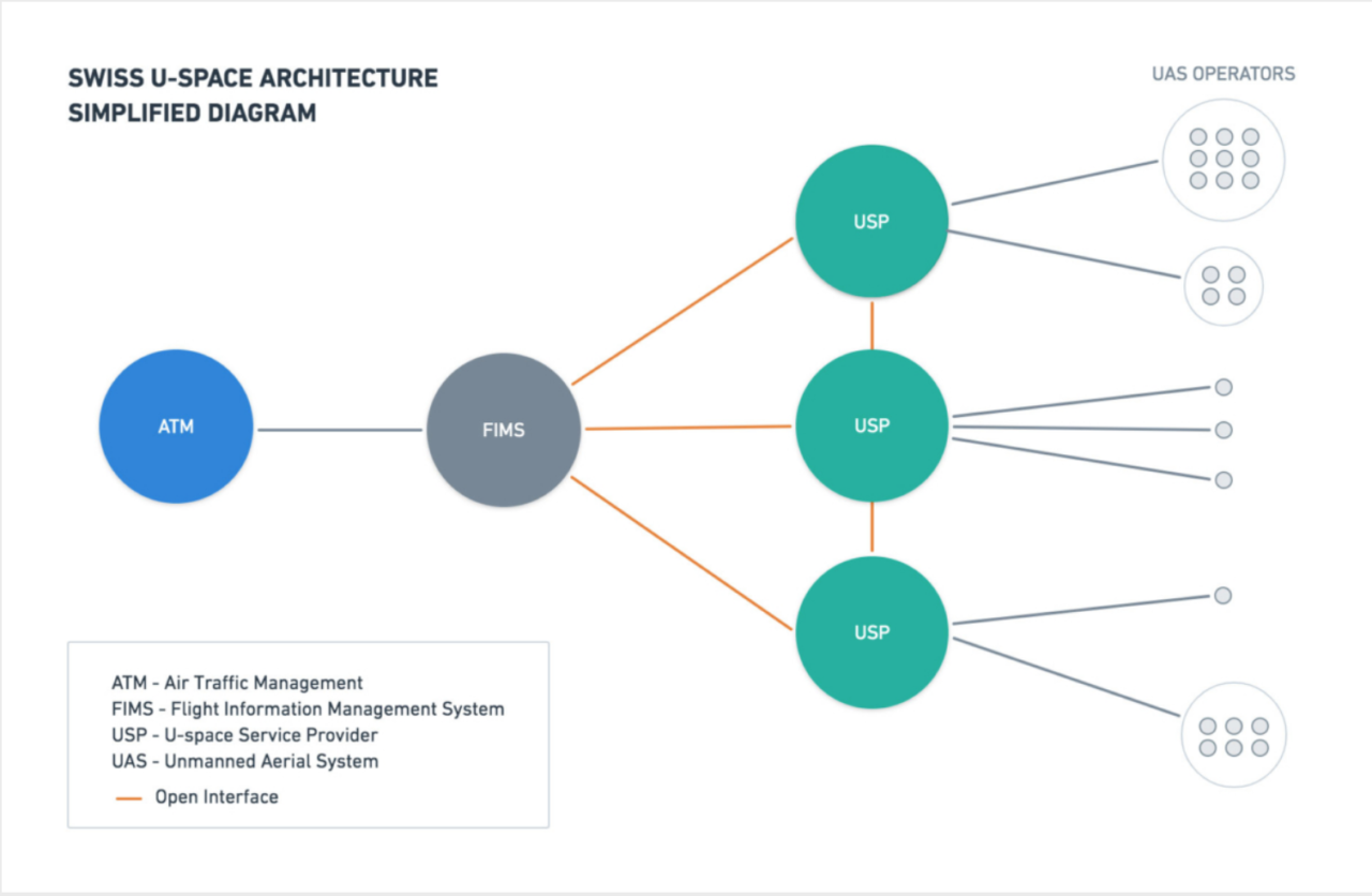
Swiss air-navigation service provider Skyguide, air-traffic management (ATM) company AirMap and the Swiss Federal Office of Civil Aviation (FOCA) have deployed a drone-management system called FIMS (flight information management system).
The cloud-based system is designed for drones and will allow unmanned service providers to send and receive data from Skyguide’s systems. It will be applicable to low-altitude aerospace operations.
FIMS will provide airspace information and real-time traffic, while relaying drone flight information back to air traffic controllers.
The flight management system follows a 2017 announcement by the two companies that they were to develop the Switzerland U-Space Implementation (SUSI) – equivalent to the U.S. unmanned traffic management (UTM) system. Zurich had the world’s first unmanned drone delivery network.
SUSI complements the safety of traditional air traffic management systems by facilitating information exchange between airspace authorities and drone operators.
In March this year, the Skyguide and AirMap ran trials using an AirMap-developed mobile app, which allowed about 200 drone operators to enter two airspaces controlled by Skyguide – Lugano and Geneva.
“Switzerland’s FIMS enables multiple service providers to connect to safety-critical airspace information using open and interoperable interfaces to deliver nationwide U-space services to UAS operators,” said Ben Marcus, AirMap co-founder and chairman.
As of March, partners in the SUSI include Skyguide, AirMap, Swisscom, Involi, Wing, Auterion, Altitude Angel, Flarm Technology, Aurora Swiss Aerospace and Orbitalize.
Courtesy: AirMap