Unmanned aircraft are keeping gas pipelines safe in Australia
Helicopters can require up to four hours of maintenance for every flight hour, but for a long time the best way to inspect a pipeline has been to send one up.
Expensive, and not without risk for crew, the job also tends to be time consuming and reactive. Now, for the first time, a pipeline in Queensland is being inspected commercially using highly automated drones.
A first for Australia, the authorisation by the Civil Aviation Safety Authority (CASA) allows operator and intelligence provider Xplorate to inspect a 500km length of underground gas pipeline almost entirely beyond visual line of sight (BVLOS) – the exception being two small, densely populated areas. It takes one hand to count the number of permits granted for commercial projects of this size globally.
Whilst the energy firm that manages the pipeline wishes to remain anonymous, some details can be given about the infrastructure and its purpose. A few metres below ground, it runs from natural gas wells in the Surat Basin northeast past Tangool before arriving to facilities in Gladstone. Keeping such pipelines operational has traditionally been a time consuming and expensive process. Xplorate’s mission in this area is to redefine how large infrastructure is inspected, allowing firms to become more proactive in their maintenance.
“This approval is going to help reduce the cost of energy in the long run. It turns reactive maintenance into proactive maintenance for our clients, making them more efficient,” CEO Ronnie Fahy tells us.
Aside from the aircraft, the key technology making these inspections possible, and attractive to commercial clients, is Xplorate’s data management and analytics division.
“Flying is one thing, but that is not actually what we do,” says Fahy, as he shows us a digital twin of the pipeline area built using data collected from initial operations. “The group is made up of Xplorate and SwissDrones, which is our manufacturing arm in Switzerland, we are the operating and intelligence arms. We’re currently developing an intelligence portal, called Xplorate Intelligence, where we bring everything together and basically deliver actionable insights and reports to the client.”
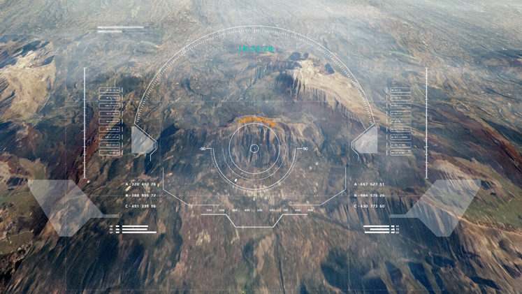
Clients don’t necessarily have specific methods of data collection, they care about the data itself and how it is presented, says Fahy. Digital twins are created using a mixture of light detection and ranging (LIDAR) – a method that uses light pulses to measure ranges to the ground to create a colourised 3D model of the terrain – and RGB (red, green and blue) data which is basically high-resolution imaging. The digital twin forms an interactive model of the asset, in this case the length of pipeline and about 20 metres of terrain either side.
SwissDrones’ SDO-50 aircraft flies over carrying both sensors at once, something most remotely piloted aircraft are not able to do. The sensors collect data on the height of each part of the terrain accurate to the nearest centimetre. Fahy shows us a hole dug out by an excavator along the pipeline route; after drawing a line around the hole, the software calculates its depth, width and cubic size, ensuring works occur only at a safe distance.
Also, sudden changes in weather such as heavy rains can significantly impact the terrain around the pipeline and energy firms need to stay on top of this too. “This is key for energy firms as what they’re really worried about is risk and integrity,” says Fahy. “Risk is the risk of them hurting other people. Integrity is the risk of a person breaking or damaging the pipeline. To keep both in check they’ve got to do inspections regularly – around every six weeks.”
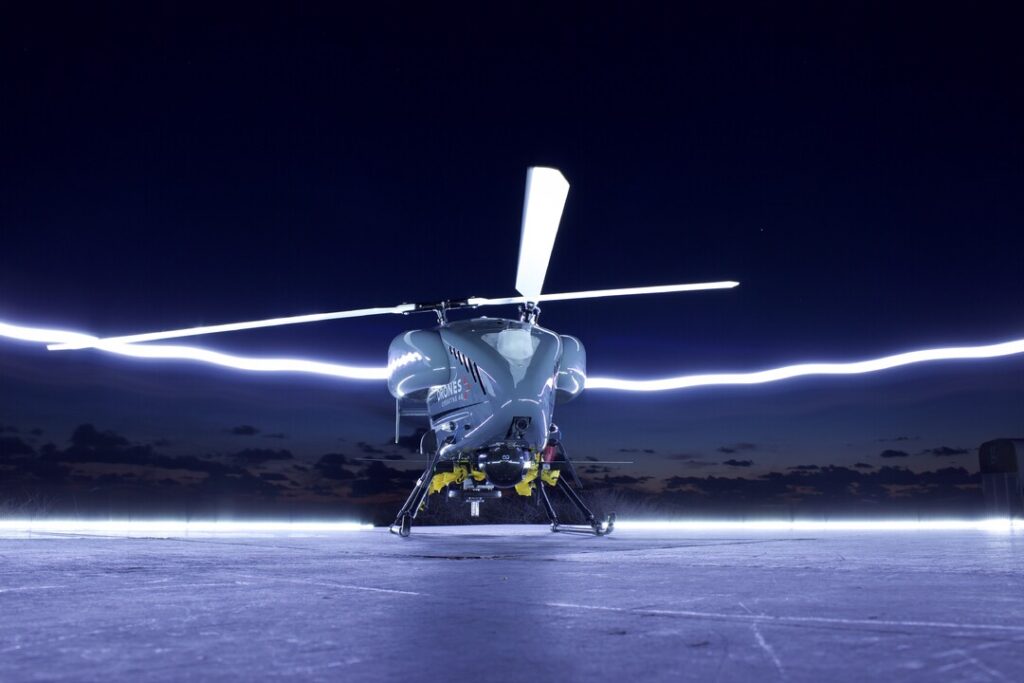
SwissDrones’ remotely piloted aircraft system the SDO-50 is capable of carrying two sensors weighing up to 45kg on missions lasting just over three hours. (credit: SwissDrones)
Xplorate is also working in other areas such as natural terrain observation. By flying over a section of jungle, the data collected is again formed into a digital twin which maps vegetation down to the individual tree. “What we’ve been able to do is run a classification. What that means is we teach an AI to tell itself what is what – is that a tree, is that high vegetation, is it ground, whatever. We can then add and remove those layers as required, count how many trees are in the area, then in the next round we can tell you by how much those trees have grown since the last flight. We can also measure where ground is solid too. By switching off vegetation we can detect changes in the surface of the jungle floor – known as a digital terrain model,” explains Fahy.
Xplorate’s intelligence is vehicle agnostic, the firm has a “right aircraft for the right job” approach. For long-range infrastructure inspection, group partner SwissDrones’ unmanned helicopter, aka SD0 50 V3, makes sense says Fahy. The aircraft is one of the leading BVLOS applications globally, it was a leader in attaining European authorisation, and among the first cohort to gain US authorisation last year.
Xplorate’s permission lasts for six years before it comes up for review with CASA. The milestone has also forged a pathway for further BVLOS authorisations (of which there are many on the way), and this is where Fahy is looking. “It is always onto the next. It is just go, go, go. We just want to continue expanding. We do have to take a step back and say fantastic, but we are at a point in the industry now where if we’re not ahead of the game we are falling behind. There are lots of companies going under, a lot of consolidation, so we’ve got to keep on,” he says. The team is now working to secure permissions to operate in the region around the pipeline’s origin that covers an area about the size of the UK.
The group is currently in the middle of its latest investment round with funds raised to be split between manufacturing of a new aircraft type in Switzerland and development of Xplorate’s Services and Intelligence division. Fahy says the new aircraft will take them to the “next level” and will be capable of attaining certification to fly in and around cities and densely populated areas where Xplorate currently operates VLOS. With operations running or in development across Australia, Middle East, North America, Papua New Guinea and some regions yet to be announced, Fahy says the new version will only help to further expand its capabilities and client reach.
“That said, we want to reduce the amount of flying as much as possible and increase the amount of data. We’re trying to flip the whole thing on its head, and value what we do from a data rather than flight hours perspective,” explains Fahy. “It is going to be a challenge to bring people round to this new way of thinking, but it is a challenge we are here for.”
Subscribe to our free newsletter
For more deep dives from SAF Investor, subscribe to our email newsletter.