Xplorate launches ‘360° Vision’ for long range drone operations
Ideas of omniscience have been discussed for millennia, usually in religious contexts, but the power to see, or know, everything has remained an impossibility.
This week Perth-based aerial intelligence solutions specialist Xplorate launched the closest thing to it in the mortal realm (at least for large infrastructure, energy and disaster response organisations).
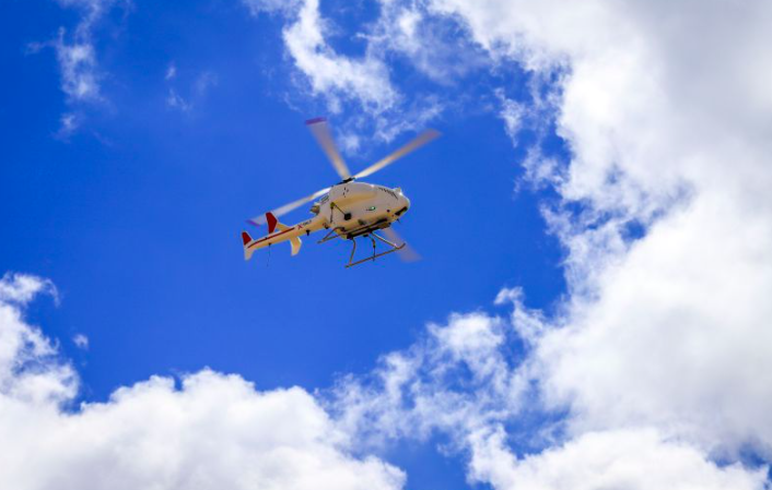
The breakthrough is a multi-sensor package, aka 360° Vision, that further expands the capabilities of Xplorate’s long-range beyond-visual-line-of-sight (BVLOS) drone operations.
360° Vision combines a survey-grade LiDAR scanner, a 100-plus mega pixel camera and a 360-degree video feed. All of which are hooked up to Xplorate’s SDO50 unmanned helicopter platform, built by SwissDrones.
The resulting combination means, for the first time, a single drone can simultaneously capture comprehensive 3D maps, crystal-clear imagery and panoramic video in one flight.
‘2.5GB per kilometre’
Ronnie Fahy, CEO, Xplorate, says the team is constantly working to reduce the data throughput which currently stands at about 2.5GB per kilometre. “So when you’re talking about thousands of kilometres you are talking about terabytes of data,” he explains.
Starlink has been the biggest step change in enabling Xplorate to be able to offer a product such as 360 Vision, according to Fahy.
“The ability to constantly have a very high speed connection is extremely helpful. So when we look at the LiDAR, camera and video feed, it is not as simple as plugging all three together. We have an integration of all three, because they all have to know that they’re all in the same spot at the very same time, which in itself is not easy to do,” he says.
The ultra-high-resolution camera takes and uploads a photograph every few seconds. Whilst Xplorate plans on offering clients live video feed soon, currently it is uploaded immediately after a flight.
Fusing datasets
Designed with critical infrastructure in mind, the LiDAR provides precise 3D models of terrain and assets, while the high-megapixel camera and 360-degree video together ensure details and angles are not missed.
Xplorate provides clients with individual raw data sets, as well as analysis of that data, which can detect changes such as ground slippage. “We found a significant earth movement on a pipeline that people weren’t aware of, for example,” says Fahy.
The company also runs data through its proprietary in-house “portal”, which is set to be announced publicly before year-end, allowing the client to view all data and reports in one place.
Humans are here to stay
Fahy is clear that Xplorate will always conduct human-in-the-loop operations. He believes AI is the perfect assistant, but it shouldn’t be signing off on a final product. With that philosophy in mind, the team has been training its AI models to survey more accurately as part of the development of 360° Vision.
“The first data sets were all manually reviewed, but we are getting to the point now where we can run it through a recognition algorithm and it can recognise tracks in the road, machinery and so forth,” he says. “The accuracy of the AI is getting significantly better by the run. And the human is then helping that by saying, ‘yes, that’s correct or no, it’s not.’”
The company has proven the concept in Australia and is now offering this capability to clients worldwide, adds Fahy.
New partner secured
On Tuesday it announced a new partnership with a “leading oil and gas company” to begin using 360° Vision and SwissDrones’ SDO50 platform to begin inspecting infrastructure. The identity of the company will be revealed in the coming months as the partnership is expanded, says Fahy.
“It was fantastic for us to bring on a new oil and gas company, it has been long year and we are only in September. I know others are feeling it too. You are at this point where the company is expected to grow but regulations and approvals and the major companies who sign off on these contracts are a bit slower.”
Regulatory burden
Fahy is keen to stress despite regulatory processes not improving, he doesn’t believe that is down to the regulators themselves. “They’re trying their best, I’ve said a million times, they’re underpaid and overworked.
“Now we have more and more approvals in the funnel. We’re a victim of our own success in a way. We are now having conversations over which approval to take on first, because they can’t be done in parallel — that is not something we’ve done before,” he explains.
A grade-based system focused on importance to national interest might be solution to help regulators prioritise approvals, suggests Fahy. “Organisations that target critical infrastructure, emergency response or anything like that. They should come first and foremost.”
Subscribe to our free newsletter
For more deep dives from SAF Investor, subscribe to our email newsletter.